July 22, 2025 | 🛩️ Trip Report: Airplane Camping on Orcas Island, WA
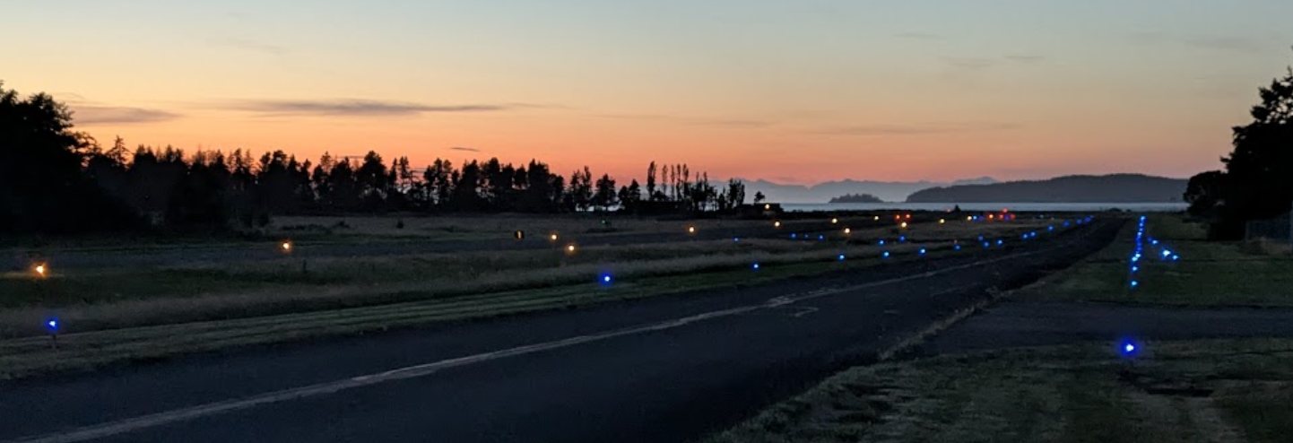
Runway and taxiway lighting define the Orcas Island Airport (KORS) at twilight, against a distant, tree-lined coast.
Preface
I'm writing and sharing this trip report because when I was preparing to go airplane camping for the first time, I didn't find all the information I wanted. Also, to the extent there is any "audience" to my website, it seems likely they would be interested.
To get the information I wanted, I called the KORS airport manager, discussed a airplane camping with a private email group of pilots, and chatted with staff at my flying club. I still didn't have all the information I would have liked. Though if I'd had complete information, the sense of adventure would have been diminished. Still, given that I was bringing my family, I wanted the trip to be as safe and fun an experience for them as I could make it.
⚠️ Facts and figures in the trip report are provided with the caveat that they are pulled from my memory and notes, and may not be accurate. They shouldn't be relied on for flight planning. Official sources of information should be used.
Summary
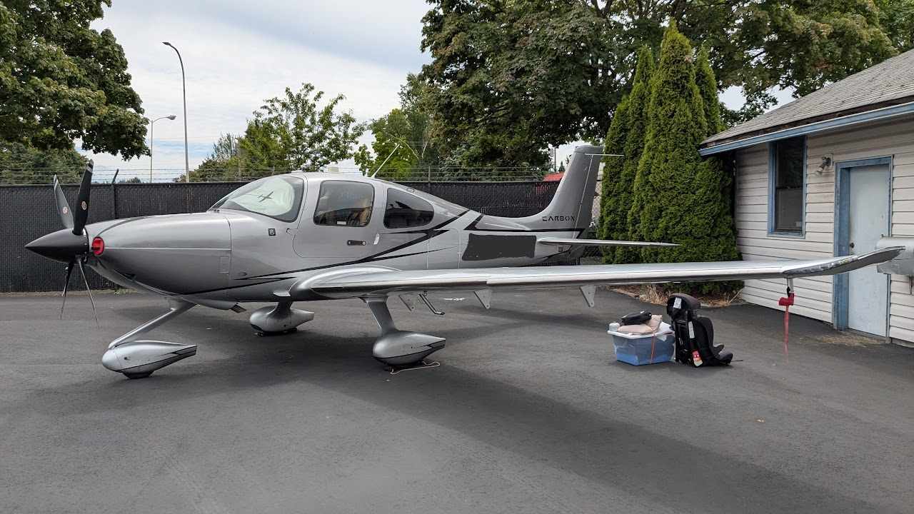
This was my first airplane camping trip. I brought my partner and my pre-schooler. We flew in a Cirrus SR22 Turbo G6 with FIKI from KRNT Renton, WA to KORS Orcas Island, WA. The purpose of the trip was to try out airplane camping and learn first-hand about it without over-committing while minimizing risk factors. We stayed just a single night and spent only about 20 hours on the island, but we made the most of it with trips into Eastsound, WA and exploration of the airport.
Planning
Location
My pilot email group helped me narrow down viable camping locations. I chose Orcas Island (KORS) over options like Electric City or Concrete, WA, due to its familiarity, close proximity to Renton (KRNT), the close proximity of its airport to a nearby town, and its reputation as a good airport camping location.
Weight and Balance
As with all flights, I try to manage risk responsibly, and because I had more variables to manage and more unknowns, I decided to constrain them further than usual. As a result, we minimized the amount of weight and volume of gear we chose to take in the plane. Although the max gross take off weight for our aircraft is ~3,500 lbs and we didn't need much fuel, I wanted to stay well within the weight and balance requirements, and far from the edges of the flight envelope.
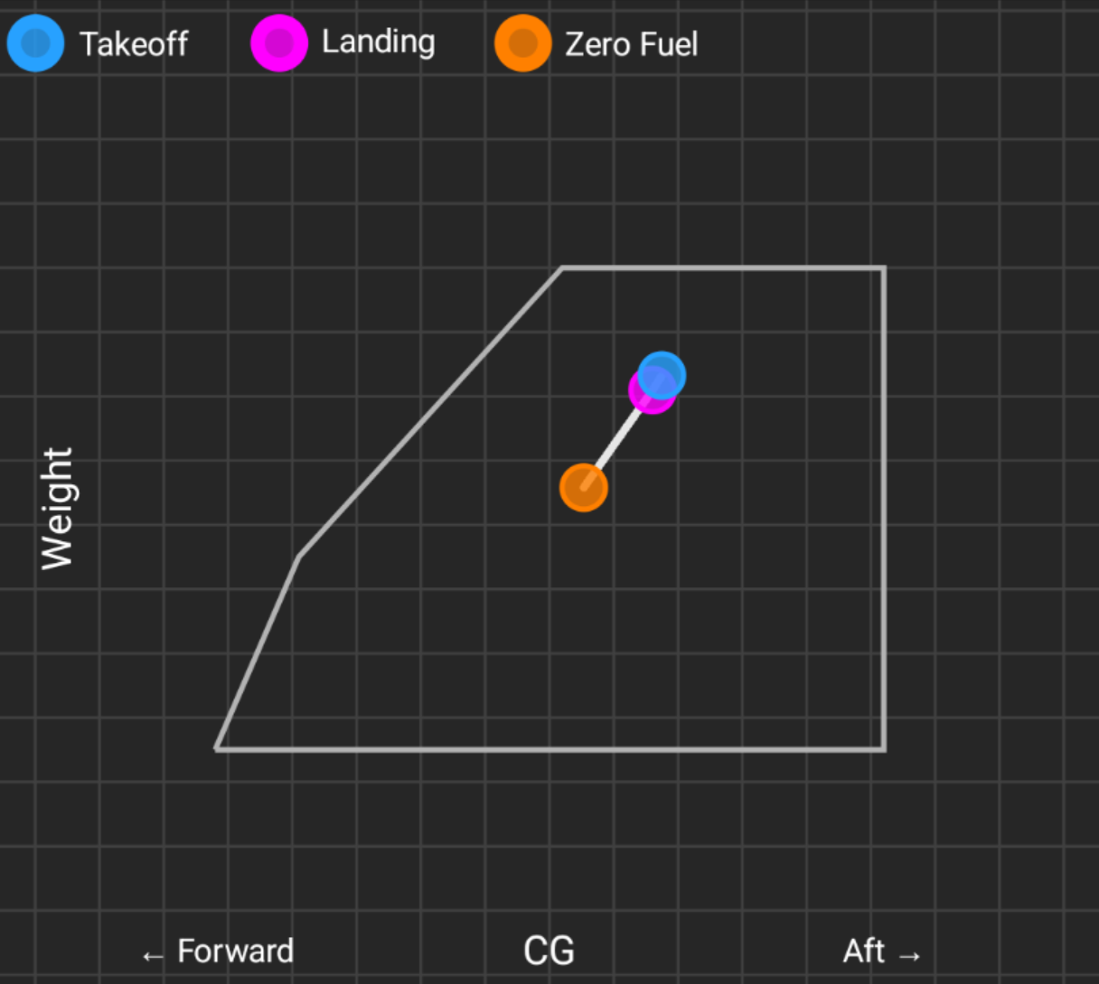
The re-created, approximate weight weight-and-balance chart for my flight from Garmin Pilot. Each phase of flight is well within the trapezoid's boundaries.
I also wanted to constrain weight in order to make sure I had minimal energy when landing at the ~2,900 foot runway at KORS. I earned my private pilot certificate flying at KPAO - Palo Alto, CA, which has only a ~2,400 ft runway, so managing a little extra weight for take off and landing wasn't nearly as big a factor as I had prepared for.
We ended up only carrying about 50 pounds more than we would have if we were just taking a day trip. We brought a small 2 person tent, 2 sleeping pads, 3 sleeping bags, a tiny camping kitchen set mostly for heating water and drinking tea, coffee, and making oatmeal or "MRE"s. We also brought a small bag for clothes, toiletries, and camping tools like flash lights, med-kit, etc. We needed very little fuel given the close proximity of our destination. Since the fueling company for the aircraft fills to tabs by default (60 gallons for this aircraft), I decided to use that as my baseline and calculated that to be more than sufficient for the round trip plus still provide significant reserves should a diversion be necessary.
I had been prepared to buckle our hiking backpack in the front passenger seat to make the weight and balance work, but at less than 50 total pounds, everything fit into the rear baggage compartment. The available space inside the aircraft ended up being more constraining than weight.
Route
Although many filed flight plans from KRNT to KORS are made direct, I wanted to fly VFR for the flexibility to do some aerial sight-seeing while en-route. The route KRNT -> KIREC -> KORS helped avoid most complex and busy airspace while giving good views of the islands and mountains while increasing proximity to viable places to land if we needed to divert for any reason. Even though we brought life jackets for every person in the aircraft, part of the reason I chose this route was because it reduced the amount of time we would be over open water.
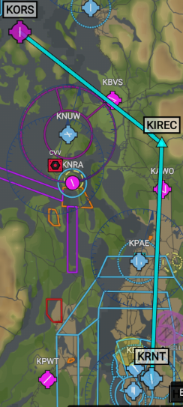
KRNT -> KIREC -> KORS as depicted in Garmin Pilot
Camping at the Airport
I found lots of useful information on PortOfOrcas.com related to noise abatement, tie downs, courtesy crew car, etc. but nothing specific to camping on the airport. I called the airport manager, and got connected to "Chip". I explained to Chip it was my first time and I didn't know what to expect. Chip directed me to the aforementioned website, and answered questions that the website didn't:
- The tent camping is where the grass tie downs are (maybe this is common knowledge in the aviation community but wasn't obvious to me figuring it out by myself)
- There are a pair of bathrooms, each with an adjoined shower, accessible via a door with a code. Chip provided the code to me.
Chip also asked that I review the noise abatement guidelines. Chip confirmed that open air fires are not allowed on the airport grounds (when I arrived I did observe a charcoal grill next to one of the picnic tables).
Activities on Orcas Island
One of the appealing features of airport camping at Orcas Island is that the town of Eastsound, Orcas Island's largest, is only a 20-30 minute walk from the airport. This is doable for my pre-schooler without too much protest. If I'd had the foresight, it would have been good to bring their scooter.
Within the town of Eastsound, there are plenty of boutique shops, a handful of coffee shops, restaurants, a few pubs, and a general store. There is also a museum, a great amphitheater and a nice children's playground.
I had also intended to take a trip to Mt. Constitution. People can drive to the top, but our family likes to hike and Little Summit Trailhead is easy to reach by car. When I talked with Chip, they also confirmed that the crew car was available first come / first served for two to three hours at a time, but reserving a rental is advised if access to a car needs to guaranteed.
Itinerary
The planning doc we used had this original itinerary, as a guideline:
Day 1
1:55pm Pack Airplane
2:15pm Preflight Aircraft
2:30pm Board Aircraft
2:45pm Wheels up - Fly to KORS
3:30pm Land @ KORSFind Tie-downs
Find Camp
Set up Camp5:00 Walk to Town?
5:30 Dinner @ Madrona or other6:30 Walk back to Tent
7:30 Snacks
8:30 SleepDay 2
Wake
Breakfast
Pack up camp
9:00 Rent Car or use crew car
9:15 Drive to Hike
9:45 Hike
12:00 Lunch
12:45 Back to plane
1:00pm Preflight Airplane
1:30pm Board Aircraft
1:45pm Wheels Up to RNT
2:30pm Land @ KRNT
2:45 Unpack plane / pack car
The actual itinerary ended up being a bit different, but having a general plan helped shape expectations for the day. It also acted as a forcing function for answering questions like: "How long does it take to walk to town?" and "Which restaurants will be open?"
Day 1
Brief
| Origin: | KRNT |
| Destination: | KORS |
| Aircraft: | Cirrus SR22 Turbo G6 w/ FIKI |
| Route: | KRNT -> KIREC -> KORS |
| Distance: | 87 NM |
| ETE: | 27 m |
| Fuel: | 9.3 g |
| Fuel on Board: | 60.0 g |
| Cruise Speed: | > 165 kts |
| Cruise Altitude: | 4,500 MSL |
| Pax: | 3 |
| WX: | 29005KT 10SM CLR 29/09 A2974 |
Departing KRNT
We arrived at the airport, unpacked the car, packed the airplane, pre-flighted, and had a fairly uneventful departure. The aircraft operated smoothly and had no issues mechanically. The only area of concern was that the Hobbs meter had 0.1 more time than the log book indicated, for which I made a note.
The weather at the time I prepared for departure was great, if a little warm for my taste. There were no clouds, and the wind was gentle and aligned to the runway despite the ATIS saying otherwise. Runway 34 was in use and aligned to my route of flight.
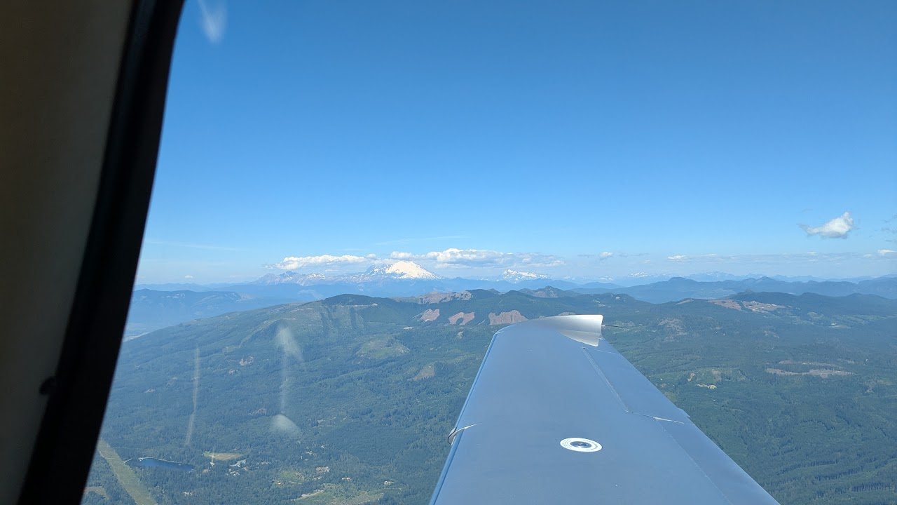
Enroute from KRNT to KIREC looking east at the Cascade mountain range
Getting Flight Following
I love flight following. I almost always get it. It allows me to always be on frequency with an air traffic controller who is looking out for conflicting traffic and airspace. I also appreciate they give me my next frequency. Occasionally they advise me when I've missed something during my pre-flight brief, like parachute operations and helpfully suggest a heading that directs me away from those hotspots.
KRNT doesn't issue flight following codes, however. This has been a minor frustration for me. I learned to fly at KPAO Palo Alto, CA where controllers issue flight following on the ground.
When I took off and after clearing Renton's delta airspace, I attempted to get flight following from Seattle. However, the commercial air traffic carriers had the controller completely tied up.
I decided to get flight following from the next controller along the route of flight. Since it would be a few minutes before I was in the next sector, I used the time to look up KPAE's departure frequency and load it in standby. However, when I switched to them to request flight following, I was told to wait for the controller change over. I originally contacted them when I was more than 11 miles south of KPAE, and by the time I got my flight following code, I was east of KPAE.
I'd very much love to be able to pick up flight following on the ground out of KRNT. The best I could conceivably do is to depart under instrument flight rules (IFR), and then cancel in the air while maintaining the assigned code and route of flight, but that seems like an abuse of the intent of IFR. It would also likely result in a long delay in take off time. I suspect the constraint to getting flight following on the ground at KRNT is one of ATC capacity, since I can get IFR clearances out of KRNT just fine.
Approaching KORS
Because of the arrival diagrams on portoforcas.com, I decided it would be best to approach from north of the airfield. Even if I wanted to preserve the option of approaching from the south, I wasn't able to get the current conditions on the radio while east of the field due to the hill, Mt. Constitution (~2400 ft elevation), between the field and I.
This was fine by me, as I'd previously been to Orcas once and landed straight-in to the south on runway 16. Once I was able to get the one minute weather at KORS, I found that I'd be landing on runway 34. There were many boats harbored in the cove just north of the runway which was interesting to see.
Arrival
I maintained 1,500 MSL while on the downwind in order to minimize noise, and had to extend my downwind a little bit further in order to get a comfortable descent and turn to base. Since I had a pre-schooler who may not be fully comfortable with clearing their ears, I wanted to keep my descent rate a little lower.
Fortunately there is a working VASI that gave me confidence I was on a good glide path once I turned final. I had a really nice, stable approach which allowed me to focus on centering over the slightly narrow runway.
Setting up Camp
After we arrived, I opted to taxi to and tie down on the asphalt ramp rather than the grass. I had neglected to inquire about taxiing on grass, what technique I would use, and how and where I would position the plane. I haven't had any real soft-field experience. Without real training or first hand knowledge, I decided to forgo taking the aircraft on the field and instead learn from the other campers and a CFI first.
We unpacked the tent and supplies, and set up a tent on the grass tie downs sans airplane. We were the only ones to do so which I'm sure raised some eyebrows. I also observed that there were in fact tiedown anchors in the grass but I had not brought any ropes with me - only wheel chocks.
Finally, we had also brought only a two person tent for our trio:
- we set up the two person at home the day before and found it to be big enough for two adults and small child
- the two person tent is substantially lighter than our four-person car-camping tent
So between the lack of a plane on the grass, and a tiny tent, we did things a little different than the other groups. When we arrived there were only two other campers: a lone gentleman, and a family of four. The family of four had two boys just a little older than our own child, which was nice. We exchanged names and origins with the others, but kept it brief as the field was baking in the sun, and it was an unusually warm day.
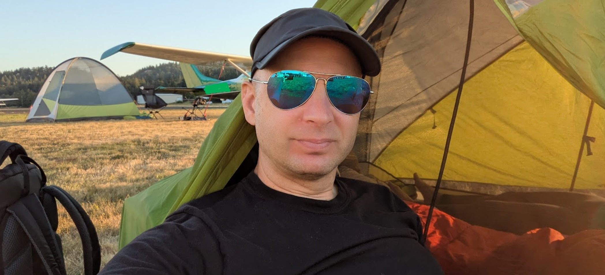
Your pilot and author resting in front of the tent on the grass tie downs at KORS
While we were unpacking and resting, we saw a helicopter arrive to join another, then both took off which was fun.
Eastsound, WA - Ice cream and dinner
We walked the 25-ish minutes into town and joined the path after crossing the road, past the fire station, through a wooded path, past some apartments and bungalows, back through a wooded area before arriving. We stopped at three places looking for a cold lemonade, but gave up in favor of getting ice cream at Clever Cow Creamery.
I had hoped to stop at a coffee shop I had been to once before on a previous trip to Orcas Island, but it has since been replaced by Orcas Bakery which was closed for the day. Instead we moseyed around long enough to work up an appetite and attempted to get food at the White Horse Pub. They were short staffed so we ended up getting food at The Madrona Bar and Grill.
Playtime and S'mores
Afterward, we explored a little more and stopped by the children's park next to the amphitheater long enough for the day to start cooling. We walked back to the camp site to rest for a little while, before going to the picnic table next to the grill to set up our little camp stove and made s'mores.
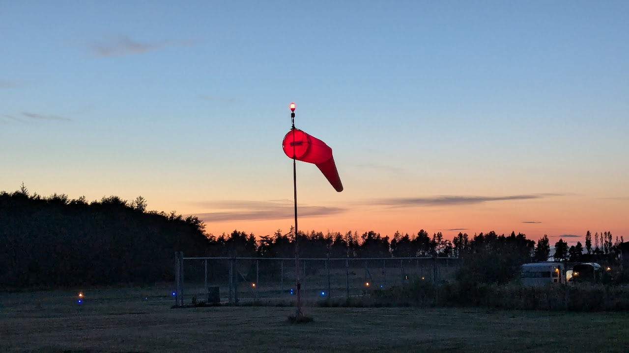
An illuminated wind sock on the field at KORS
After s'mores and some more chit-chat with the other campers, my partner and child laid down for bed, while I went for a walk to explore the airport grounds, walk the taxiway, and get some pictures of the setting sun.
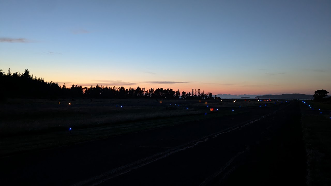
A dark runway lit by taxiway lights looking out at the water under the oranges and pinks of a sun set
Day 2
Awake
None of us slept that well, unsurprisingly. It was less that it was a small tent, and more that most of us are used to sleeping in dark quiet cool rooms at home. My kiddo woke up as soon as it started getting light out, around 5:15am or so. This woke up my partner, who read to him while I fell back asleep for an hour-ish.
Breakfast
After I woke up, I got out the camp stove, went to one of the nearby picnic tables, and boiled water to make coffee, tea, and oatmeal for the kid. The day was still cool, and other campers were starting to wake. He wasn't that hungry, so we packed up breakfast and took turns going to the bathrooms to change and get ready for the day.
Mourning Routine
The bathrooms are nice enough. Better than state campground bathrooms and better than many motel bathrooms. Clean, well supplied. They are locked behind a keycode-door whose number I received from the airport manager when I called them the previous day. I didn't shower since we were heading home the same day but it appeared the hot water was abundant given the proximity of the water heater and steam / humidity of the bathroom.
Back into town
After we broke down the campsite and packed the plane, we walked into Eastsound again so we could get proper coffee, tea, and pastries at The Dragonfly Coffeehouse - a literal house converted into a coffee shop. The coffee house had quality selection of coffee, tea, and home-made pastries. They also have fantastic outside seating on a grassy lawn in the back, but we opted to sit on the front porch.
We also stopped by Darvill's Bookstore to get a postcard and look for a book for our child. Darvill's is quaint as it has a little coffee stand inside. The coffee stand has a little window to look out and binoculars to bird watch. I exclaimed to the barista how I admired his office view.
Then we walked out to the passenger dock via one of the side streets to look out over the water. This was largely unremarkable but it is always fun to explore.
We began wrapping up our day and made a couple more stops: one by the general store to let our kiddo pick out a toy that we hope he will remember the trip by, another by the local grocery store, Orcas Island Market, to get lunch-to-go from their deli, and one at the Orcas Island Historical Museum, to learn some of the local history.
Finally, we played at the outdoor park, "The Playground on the Green", for awhile before we decided to walk back to the airport to get ready to return home. We felt a few sprinkles along the way and the air seemed to cool. We observed several aircraft departing the island as low clouds rolled in.
Lunch and Preflight
When we arrived back at the airport, we sat at a picnic table to eat, felt the cool air moving in and observed the clouds rolling. I decided to begin pre-flighting in case it started raining harder - and it did.
There were no surprises during pre-flight, and the rain continued as I helped load my passengers. Although I was prepared to file and depart IFR if necessary, the weather forecasts and one minute weather gave me confidence that it wouldn't be.
Return Flight
I followed the same route back as I did to the island so my route was: KORS -> KIREC -> KRNT but departed KORS on runway 16 and departed the area to the south.
Once we left the area I picked up flight following from Whidby Approach. When I made my request, I forgot to ask for it "with handoffs". This is important if you want Whidby Approach to hand you off to the next sector once you are beyond their airspace. If you don't say this, they will give you a "local" code which if I recall correctly starts with a zero. Since I had forgotten to do this with Whidby, I apologized and clarified I wanted handoffs, and then got a new code.
We cruised back at 5,500 feet and I briefly considered descending early to get below a cloud layer that appeared to be around 4,000, but after checking the weather at a few airports between my location and my destination, I decided the safest option would be to maintain my altitude and descend closer to my destination, and picking up IFR only if the layer didn't allow for it.
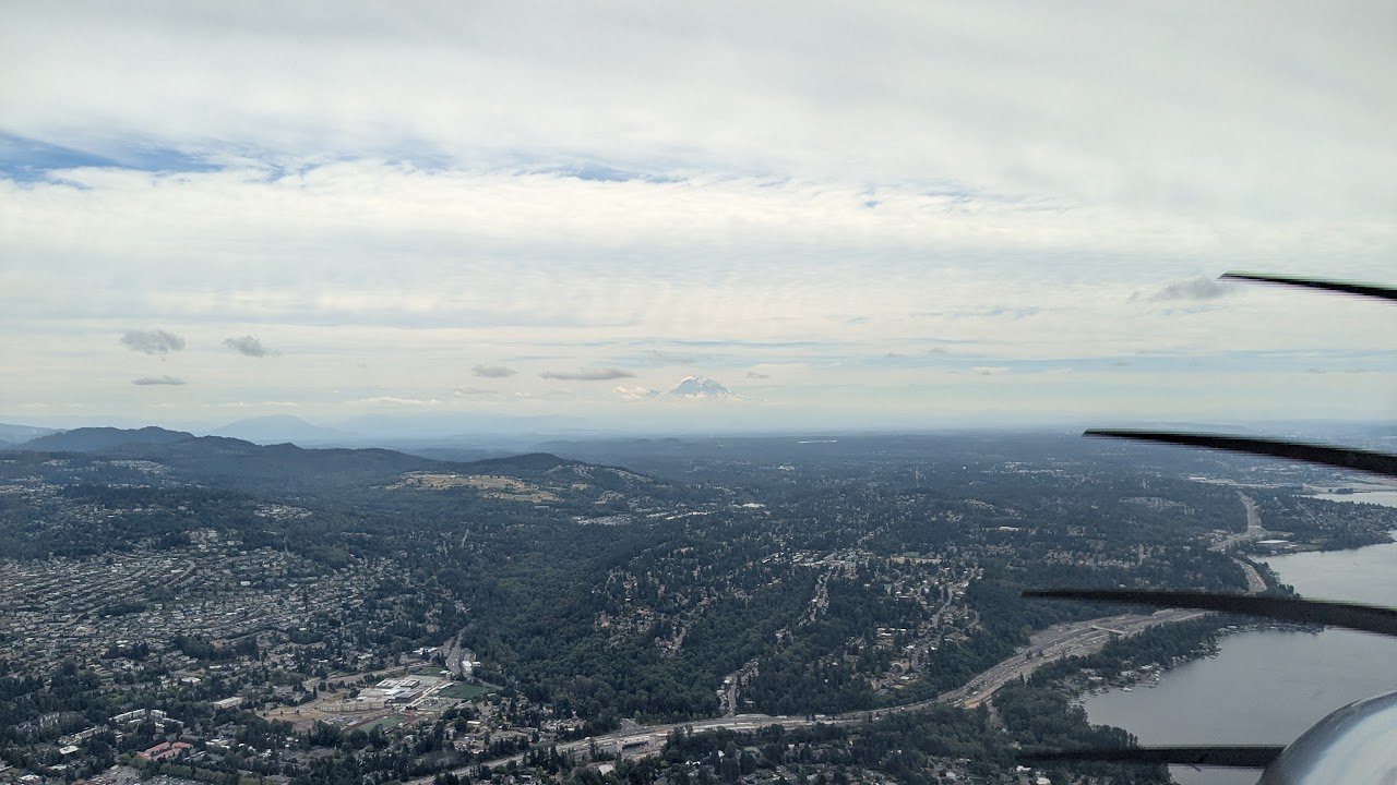
Entering the East Sound north of Renton - Mt. Rainier in the distance peeking between the cloud layers
It was at this time that my child began getting a little loopy. He kept chortling into his microphone - presumably because he heard his own voice and found it funny. I was slightly concerned the decrease in air pressure, going rapidly from about sea level to 5,500 feet, was making him slightly hypoxic, so I asked my partner who was sitting next to him in the rear seat to check his lips and fingers - which were normal. He probably was just over-tired from a long two days, not napping for either, not sleeping well, and waking up early. Fortunately the Cirrus has passenger audio separation so that I could press a button on the audio panel and isolate myself from them: just me and ATC. When check in on them, my partner was trying to keep my kiddo from falling asleep since we wanted him to have a longer nap and the flight would be relatively short.
I'm glad I had flight following, as I had a potential conflict as I was about 13 miles or so north of KRNT: I needed to descend, but I had opposite direction traffic right at my 12 o'clock at the altitude that I wanted to descend to - 2,500. I was under the outermost ring of the Seattle Bravo airspace and would be entering the inner ring if I didn't descend. In my experience, air traffic controllers are reluctant to issue clearances to VFR aircraft - which would be very understandable, and I definitely wouldn't want to enter one without a clearance. So I was caught between an airplane and a hard place of sorts. If I had to, I'd make a turn or fly a 360 degree circle and return to the same course.
I pulled the throttle back so I could cruise at a lower speed while I decided a course of action. Since I was on flight following, I informed Seattle Approach that my intent was to remain at my altitude until the aircraft passed below then descend to 2,500. Seattle Approach helpfully gave me a Bravo clearance "if I needed it". With that, I went ahead and throttled back up and once I observed the aircraft passing below, I began my descent with no worries of busting airspace or aircraft.
The arrival and taxi back was uneventful. However when I got to the tie downs, none of the typical spaces were available, as a Cirrus SF50 Vision Jet was occupying the one of the spots used for the SRs. I decided to park and chock in a corner that I observed another SR park the previous day. My kiddo helped put the wheel chocks in place.
Our reliable Cirrus SR-22 Turbo chocked in the corner of the ramp at KRNT
We unpacked the plane, loaded up the car, and drove home, and my kiddo fell asleep on the way home. He didn't wake up for two more hours - even when we unloaded him from the car. I think that is a good indicator of a successful adventure.
Reflection
A goal of the trip was to learn about airport camping in a low risk way. Reflecting on what we learned is that:
- For just the three of us, airplane cargo space is a bigger constraint that weight-and-balance (barring other performance constraints like runway length, density altitude, elevation, etc.). As such, next time we will likely bring the larger tent, the full size camp stove instead of the small backpacking camp stove, and camp chairs.
- After talking with a CFI and the other campers about taxiing on the grass, I'll feel more enabled to do so instead of parking on the ramp. Since Cirrus, being a low wing, will provide less shade for the tent, I'll also be mindful of the orientation of the plane due to the angle and path of the sun when I choose my tent spot.
- Generating a list of questions prior to calling the airport manager was a good move - regarding bathrooms, showers, building codes, gate codes, car rentals and crew cars, local activities, etc.
- Bring rope for tie-downs
When I asked my family what they thought about our adventure they said:
-
My kiddo:
- "I liked all all the things!"
- "The s'mores!"
- "Next time stay for 3 days!"
-
My partner:
- "Seeing all the airplanes takeoff and land, talking to the other campers"
- "Did not like lack of shade at campsite"
- "Next time lets explore more of the island - probably rent a car"
-
My observations:
- The walk to Eastsound was short-ish and mostly shaded which was nice
- Eastsound has mostly quaint smaller mom-and-pop local businesses common for small towns
- Island communities typically rely extensively on tourism, and I worry that businesses may struggle if there is a reduction in visitors - which seems likely in the next couple years
I think we are well established to plan another airplane camping trip and am aware of a handful other locations in the PNW that we can try next.
If you have recommendations, questions, comments, or reactions to this trip report, please follow me on Mastodon: https://hachyderm.io/@iw